A couple of interesting stats from the 1950 ANNUAL REPORT
NUMBER OF MARKED GRADE CROSSINGS 13 NUMBER OF MILES OF TELEPHONE LINE 93
Track
Two photos Brooks Stover - 2007
Photographer and date unknown
 | ||||
RAIL SIZES
I have the original 1950 BC&G ANNUAL REPORT in my collection. It lists the track weights as:
70 lb. - 16.55 miles
85 lb. - .26 miles
105 lb. - 1.79 miles
Some sources indicate that during the period from 1956 to 1960 the rail was upgraded to 110 and 112 lb. along the entire mainline and 15,000 new ties were installed.
In June of 2007 during a visit to the BC&G, cast dates of 1921 and 1923 were observed on many sections of rail along the right-of-way.
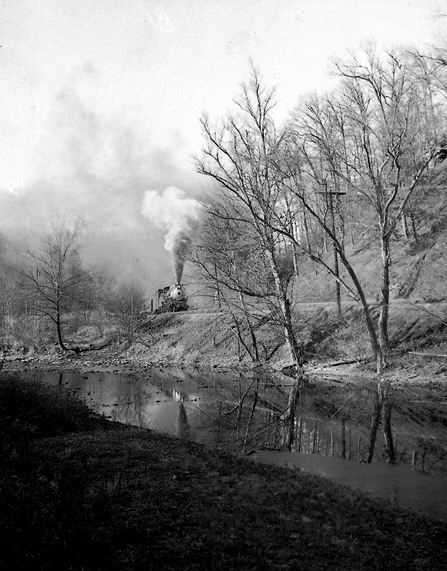
This is one of the few photos I've seen of a train out on the main in the wooded portion of the line. This train might have been stopped, although the smoke plum doesn't suggest it, because it is unlikely there is room for the photographer to get out of the way without falling in the "Buffalo". The trees form a beautiful full canopy over a great deal of the line. On an accurate model railroad you'd not be able to see the train a good portion of the time for the trees!
While the BC&G wasn't long in milage, in the later years it certainly had railsizes befitting a much larger line...
TRACK MILEAGE
This information from the 1950 Annual Report:
TOTAL MAINLINE TRACK 18.6 MILES
YARDS and SIDINGS 11.0 MILES
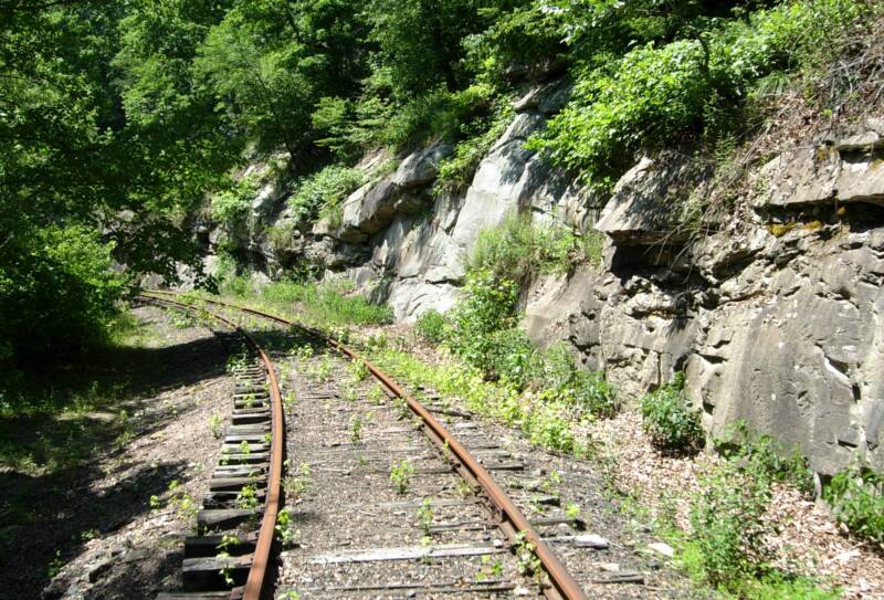
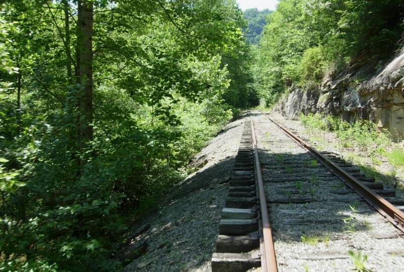
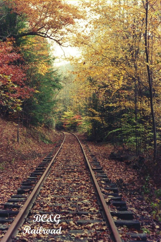
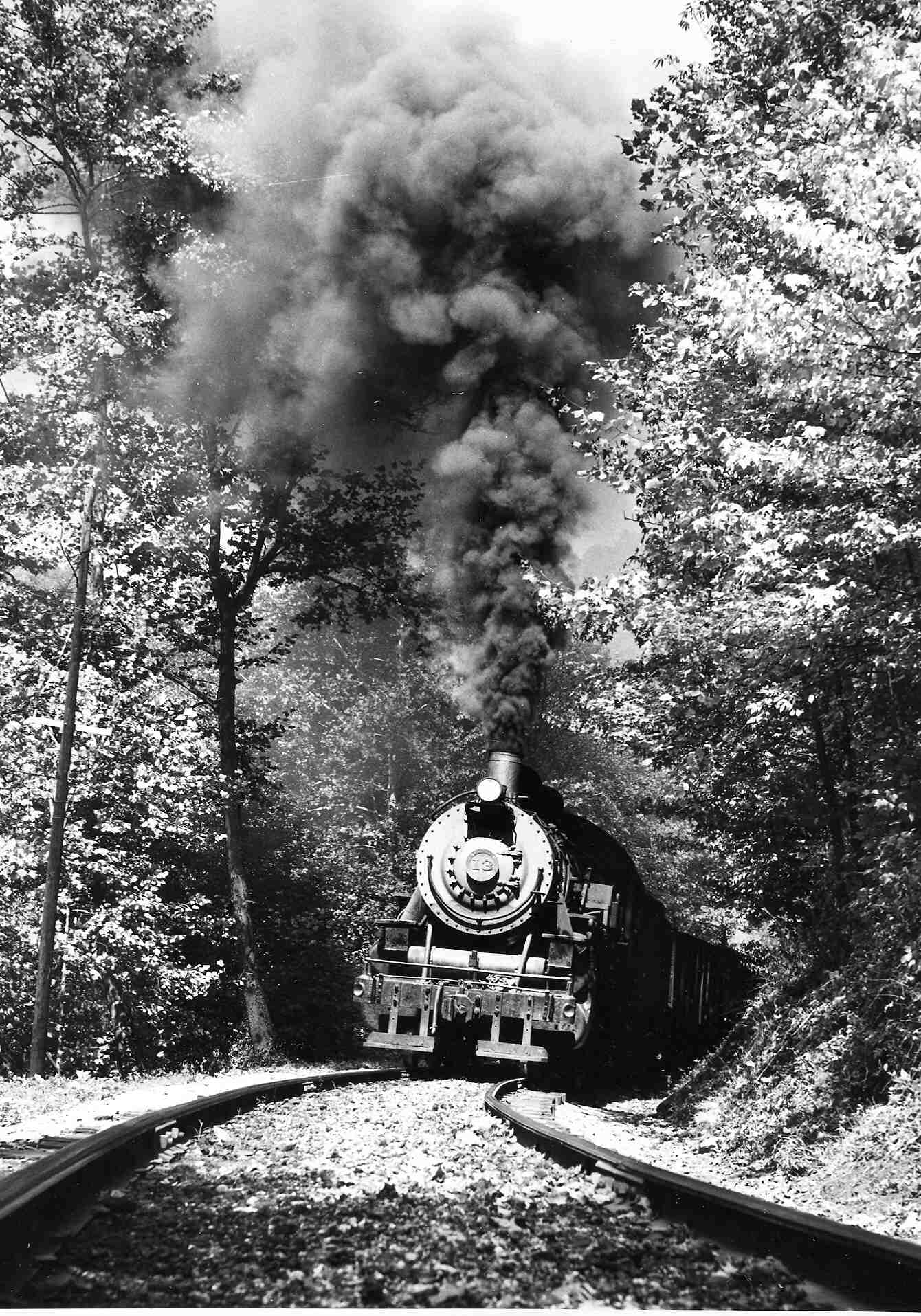
Photo by John Killoran, circa 1959
SIDINGS
Location, Names & Lengths
This information is from a 1993 conversation with Bobby Caruthers
The heart of a railroad is, of course, its track. The BC&G had a mainline that meandered through beautiful mountain scenery. This page contains a collection of visual and statistical infomation about the trackplan, roadbed and rails that carried the 60 car coal trains for over a half a century. Amazing as it may seem, 14 miles of the original 18 miles of track are in place today.
Al Chione collection - October 1960
Dirt roads paralled the track between Cressmont and Swandale and again near Widen. The rock cuts along the right-of-way are clearly visible in this 1960 photo.
BALLAST
The ballast on the BC&G was made from the ashes of burnt mine tailings. In the coal industry is is called "Red Dog". It is said that red dog is superior to ballast made from cinders. (NRHS BULLETIN, 3rd Qtr 1955).
Near Dundon Yard - Called #1 and #2
B&O Interchange - Called #3 and #4
Avoca - 40 car capacity
Adair - 15 car capacity
Cressmont - 15 car capacity (confirmed by Manning)
Swandale - Boxcar siding - 10 car capacity
Second siding - 30 - 40 car capacity
Whitstone - 15 - 20 car capacity
Long Straight - 40 car capacity
Eakle - 3 -4 capacity for gob cars oly
According to Bobby Caruthers, sometimes when coal wasn't selling, all the sidings would be full of loaded hoppers. Sometimes, he claimed, they would dump loaded hoppers on the gob pile if the B&O needed the hoppers back!
INTERESTING STORY
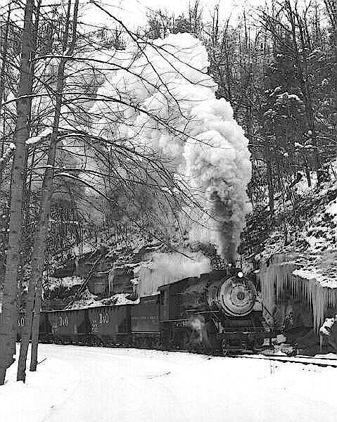
As if the grades and curves weren't challenge enough, the BC&G had to contend with winters in the mountains!
STONE WALLS ALONG the BC&G MAINLINE
I have no photos, but during the summer 2007 visit Roger Nutter pointed out the small stone walls, about 24" high in about 10 locations along the right-of-way. They varied in length but were in the range of 40 feet or more. There were installed to prevent erosion of the bottom of the hillsides along the track.
For sheer beauty, what could be nicer than autumn in the mountains!
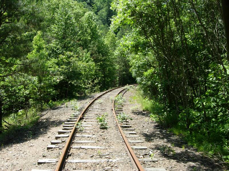
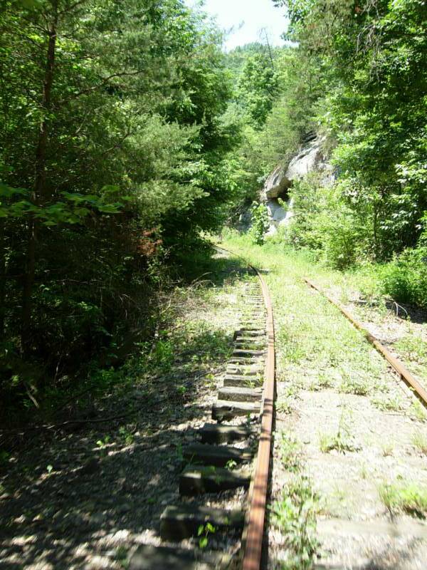
Three photos Brooks Stover June 2007
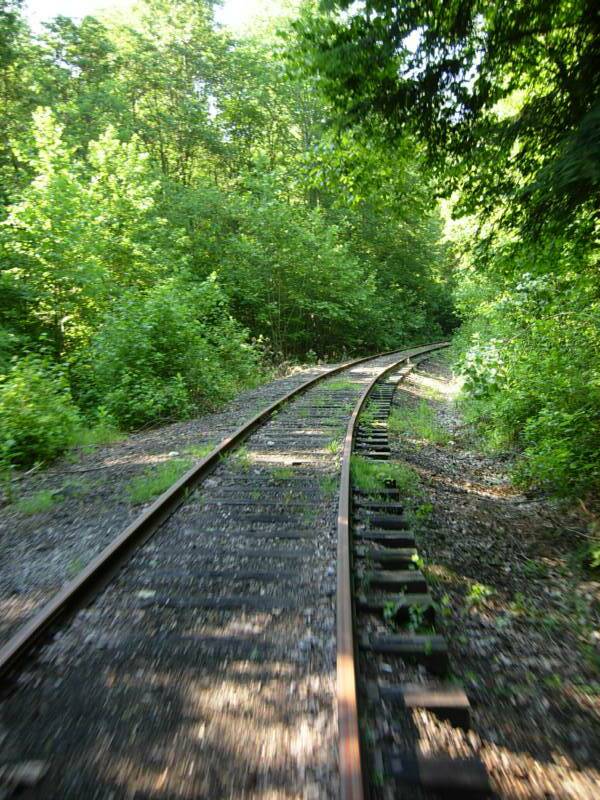
These three photos demonstrate the meandering nature of the BC&G right-of-way!
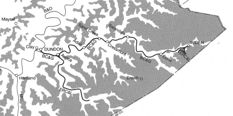
Nicholas County
Clay County
This might be the best map of the BC&G. It was taken from inside the back cover of the Warden BC&G book. No source for the map is indicated in the book. Several items are noteworthy. First, several of the smaller towns are identified including Adair, Eakle and Enoch (which was not on the railroad). Also both Dundon and Clay are shown along the B&O. According to the 1954 issue of B&O Form 6, both Clay and Dundon were listed as stations. The telegraph "call" for Dundon is listed as DN and for Clay as "SO". The distance between the two station is listed as 2 miles. The station agent in 1954 at Dundon was "L.E. Woofter" and at Clay it was "W.H. Gross".
In the text accompanying the map above, the dotted line from the BC&G to the B&O south of Clay is refered to as the "Dundon Branch". It was shown on the 1917 timetable and formed a wye that allowed turning of engines. When it was removed (date unknown) a wye was built at Avoca (shown). Interestingly, in the 1954 B&O Form 6 document, a wye is still listed in the key as being in place at Clay.
The 1954 population of Dundon is listed in the B&O Form 6 as 88 and for Clay the population is shown as 511.
The B&O Form 6 lists the following siding lengths: DUNDON Passing Siding 80 Cars
Company Siding 80 cars
SOUTH DUNDON Company Siding 10 Cars
CLAY Passing Siding 50 cars
Company Siding 16 cars
(Unfortunately, this writer could not find a definition for the two types of sidings. Nor is it clear where "South Dundon" was. Perhaps a reader can help. The 80 car capacity at Dundon is consistent with the oft-cited 60 plus cars per day exchanged with the B&O.)
At Avoca, the track labeled "ERC&L" is the Lilly Fork logging line. At Widen, the switchback, labeled "ERC&L" is the track to the gob pile.
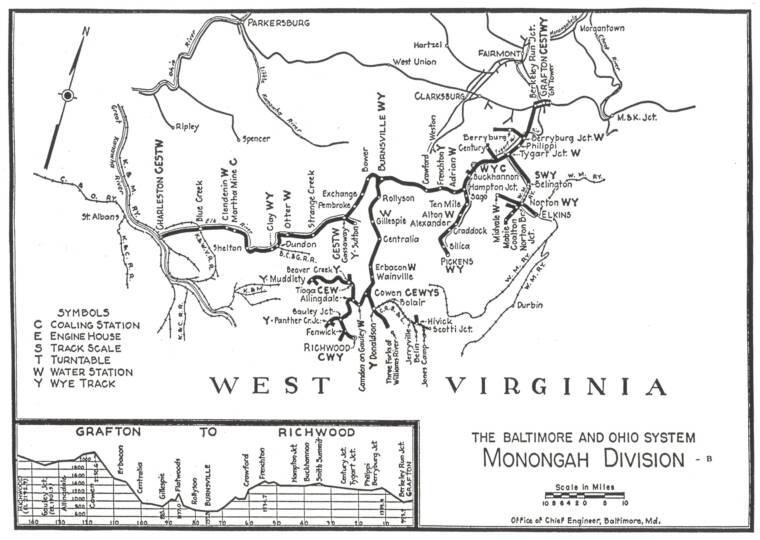
This map of the B&O Monongah Division shows the BC&G (yellow arrow) interchange was about halfway between Charleston and Grafton, the western and eastern extremes of the division. The town of Clay is also visible on the map. It was a local from Grafton that serviced the BC&G interchange. The notations show that there was both a wye (Y) and water tower (W) at Clay at the time the map was prepared. The date of this map is unknown but it was clear prepared during the steam era.
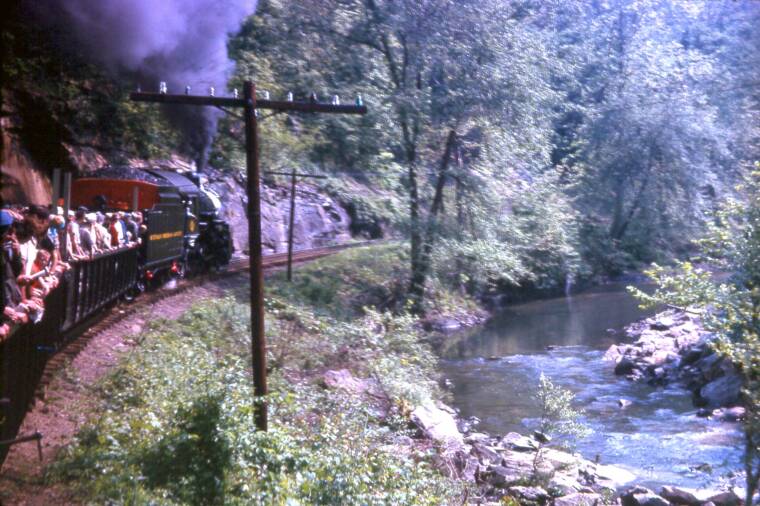
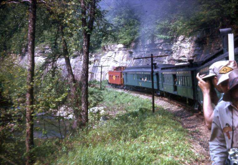
These two photos taken by John Phillips during the May 30, 1963 fan trip show very clearly the way the BC&G ran along the Buffalo Creek on a small ledge between steep hillsides and the water. One person knowledgable of the railroad said that the BC&G was a "standard gauge railroad with the character of a narrow gauge". Based on these photos, and my own experience riding the rails in speeder in 2007, that statement is surely correct.
These two images were taken in 2007 during a speeder ride along the remaining 14 miles of BC&G track. They reinforce that the rails were laid on a narrow ledge between the rock faces and the creek, out of sight on the left in these images.
GRADES
Phil Bonzon has studied US Geological Survey topographical maps and calculated the following average grades between each major location on the BC&G. These are averages between the points and there may have been sections steeper or shallower than the averages shown.
DUNDON near B&O interchange (BM 708 ft) to AVOCA WYE (BM 760 ft) Distance: 1.8 miles Average Grade: 0.6%
AVOCA WYE (BM 760 ft) to SAND FORK BRIDGE (BM 800 ft) Distance: 4.8 miles Average Grade: 1.6%
SAND FORK BRIDGE (BM 800 ft) to CRESSMONT (BM 828 ft) Distance: 1.8 mile Average Grade: 0.3%
CRESSMONT (BM 828 ft) to SWANDALE SAWMILL (BM 950 ft) Distance: 2.7 miles Average Grade: 0.9%
SWANDALE SAWMILL (950 ft) to WIDEN STORE (BM 1127 ft) Distance: 7.0 miles Average Grade: 0.5%*
419 foot total rise in 18.1 miles** =AVERAGE GRADE OVER ENTIRE LENGTH OF RAILROAD: 0.44%
*On page 66 of the Warden book there is reference to the grade near the gob pile being nearly 1.5%, but this has not been confirmed by any other source or computation.
** 18.1 miles as measured on the topographical map. 18.6 miles is the most often cited number for the length of the railroad.
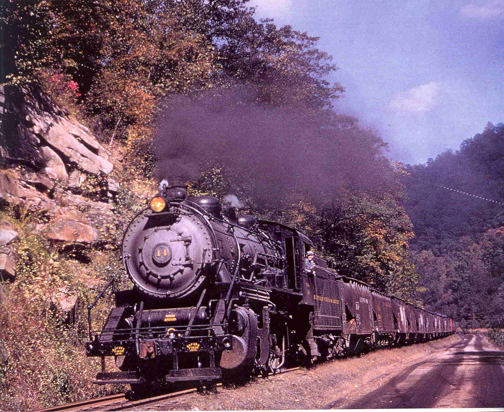
Artie Barkley provided this image of BC&G #14 on the mainline near Cressmont. It was taken in November of 1963, just weeks before the Rich Run Mine closed. Notice that the locomotive's reflection is visible in the Buffalo Creek in the foreground.